會員登錄
軟體搜尋
您的位置: 網站首頁 >> 程式軟體光碟 >> Mac麥金塔 >> 商品詳情
商品詳情
|
商品編號:CB18501 碟片數量:1片 銷售價格:80 瀏覽次數:26611 
【轉載TXT文檔】 |
您可能也喜歡:
CB19449--IntelliJ IDEA v9.0.4 Ultimate Edition MacOSX 最好的Java IDE集成開發軟體 英文破解版
CB19130--Color Finesse PI v3.0.2 MacOSX 色彩校正系統軟體 英文破解版
DVD13815--Apple - Office 2011 for MAC 大量授權免序號 可正常升級 (Word、PowerPoint、Excel、Outlook 一次擁有 MAC必備文書處理軟體)(DVD一片裝)
DVD15223--CEI ENSIGHT GOLD v10.0.2h MACOSX 科學工程虛擬系統軟體 英文破解版(DVD一片裝)
DVD12171--AUTODESK ALIAS DESIGN V2011 MACOSX (Alias Design工業設計軟體) 英文正式版(DVD一片裝)
商品描述
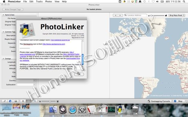
PhotoLinker v2.2 MacOSX 軌跡照片同步 英文破解版
![]()
破解說明:請使用core_keygen序號機產生序號
軟體簡介:
PhotoLinker v2.2 MacOSX 軌跡照片同步 英文正式版
官方網址:http://www.earlyinnovations.com/photolinker/
PhotoLinker 是一套可以讓你的 GPS 軌跡同步到照片 EXIF 的 Mac 工具
PhotoLinker provides an unprecedented level of map, GPS track and
photo tag interactivity, making photo annotation a compelling
project and not a dreadful chore.
Key features include:
* A completely customizable metadata editor to facilitate a
streamlined and efficient workflow. PhotoLinker complies with the
recently released (9/2008; rev 2/2009) recommendations of the
Metadata Working Group, ensuring proper handling of your photos'
metadata.
* Interactive geotagging with live updates to proposed locations
as geotagging critieria are changed. Photos can also be manually
geotagged by pinpointing a location on a map, entering the
coordinates manually, or tagging them to waypoints.
* PhotoLinker's track and waypoint browser handles years of data
and millions of track points imported from your computer or
downloaded directly from your GPS receiver. Tracks are
automatically cataloged by date and displayed on an interactive
map where the size and color can be adjusted.